Answer 1:
Very nice pictures, it's fantastic that you are making such cool observations while hiking. The more you learn about geology, the more interesting each hike gets! Learning about how these rocks and their features form makes viewing the landscape a whole new experience.
The sandstone at the top of Arlington peak is called the Matilija Sandstone. It is very prevalent in the Santa Ynez Mountains. In fact, it's the most prevalent sandstone you see "outcropping" (a geology term for being exposed at the surface) when you look up at the mountains from the coast. It is more resistant to weathering (breaking down) and erosion (transport of the broken down pieces) than the surrounding shale units, which is why it makes up the rugged and steep mountain peaks. Read more here.
This sandstone unit is about 50 million years old! It was formed in a shallow ocean environment near San Diego before it was translated north from movement along the San Andreas fault and "uplifted" and "folded / tilted" into its current position by movement on local faults. The Santa Barbara area is still actively undergoing "compression", and each earthquake brings these rocks up to higher elevations, and eventually result in the mountains we see today. This takes a long time and many earthquakes over millions of years.
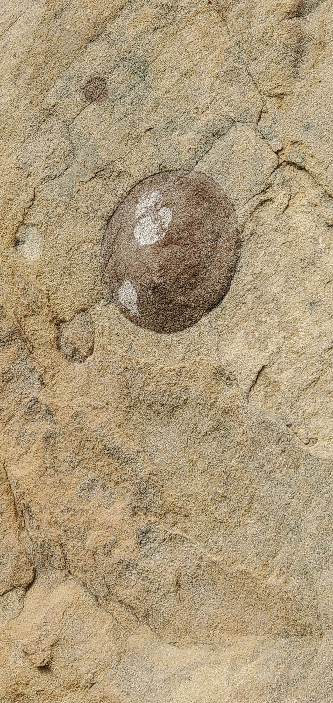
For the formation of this rock unit, rivers transported sand, and sometimes gravel and cobbles all the way to the coast where they are deposited offshore in the ocean. The terms, sand, gravel, and cobble are names given to pieces of rock based on their size. Sand has a diameter of 1-2mm (< 1 inch), gravel has a diameter of 2 - 64 mm (up to ~2 inches), and cobbles have a diameter of 64 - 256 mm (up to ~ 10 inches). Anything larger than 10 in in diameter is called a boulder. As the sand, gravel, and cobbles are transported out the ocean from large storms, they get deposited in layers that eventually get compacted / compressed and the overlying pressure causes it to form into a rock.
In your first picture, that larger "clast" or piece of rock embedded in the finer-grained sand looks like a cobble (between 2 - 10 inches in diameter). The cobble was likely rounded by transport in rivers and made its way to the coast where a large storm brought all the way offshore to be deposited with the sand. Only large storms can transport bigger rocks out this far offshore, so that's why there are so few of them. As you go into deeper water, there is less energy to transport larger material. So, the general concept is that the sediment gets smaller and smaller (finer-grained) the further you get offshore. There are also small marine fossils in this sandstone. This is how we know it was in a shallow ocean environment and why the larger cobbles are more rare to find. The shale units of the Santa Ynez Mountains are very fine-grained, so they were deposited even further offshore before earthquakes moved them to their current position in the mountains.
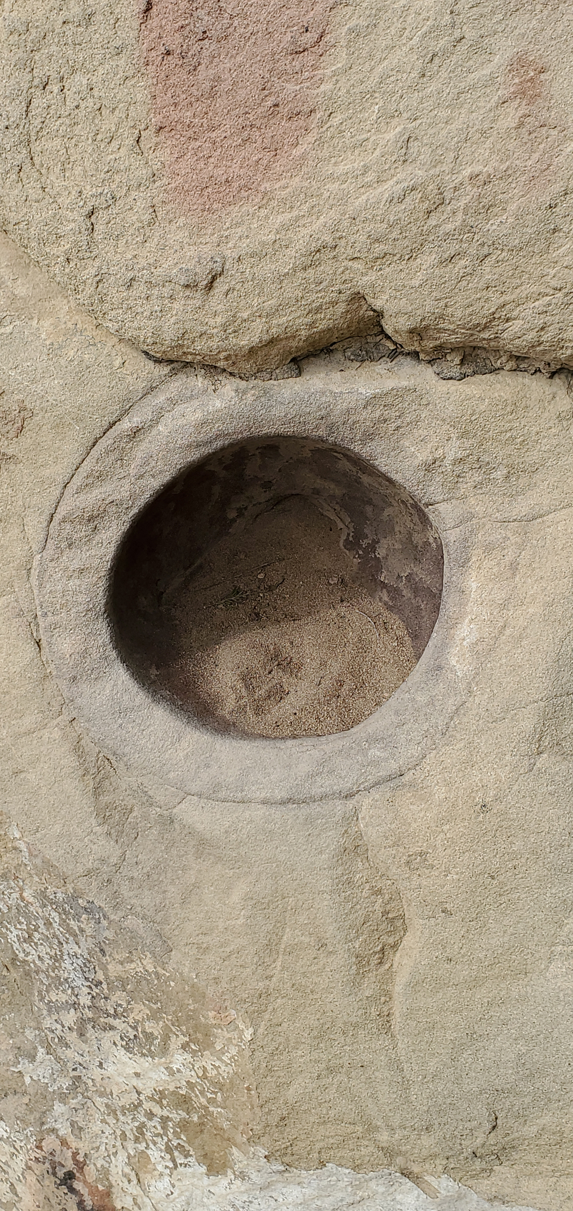
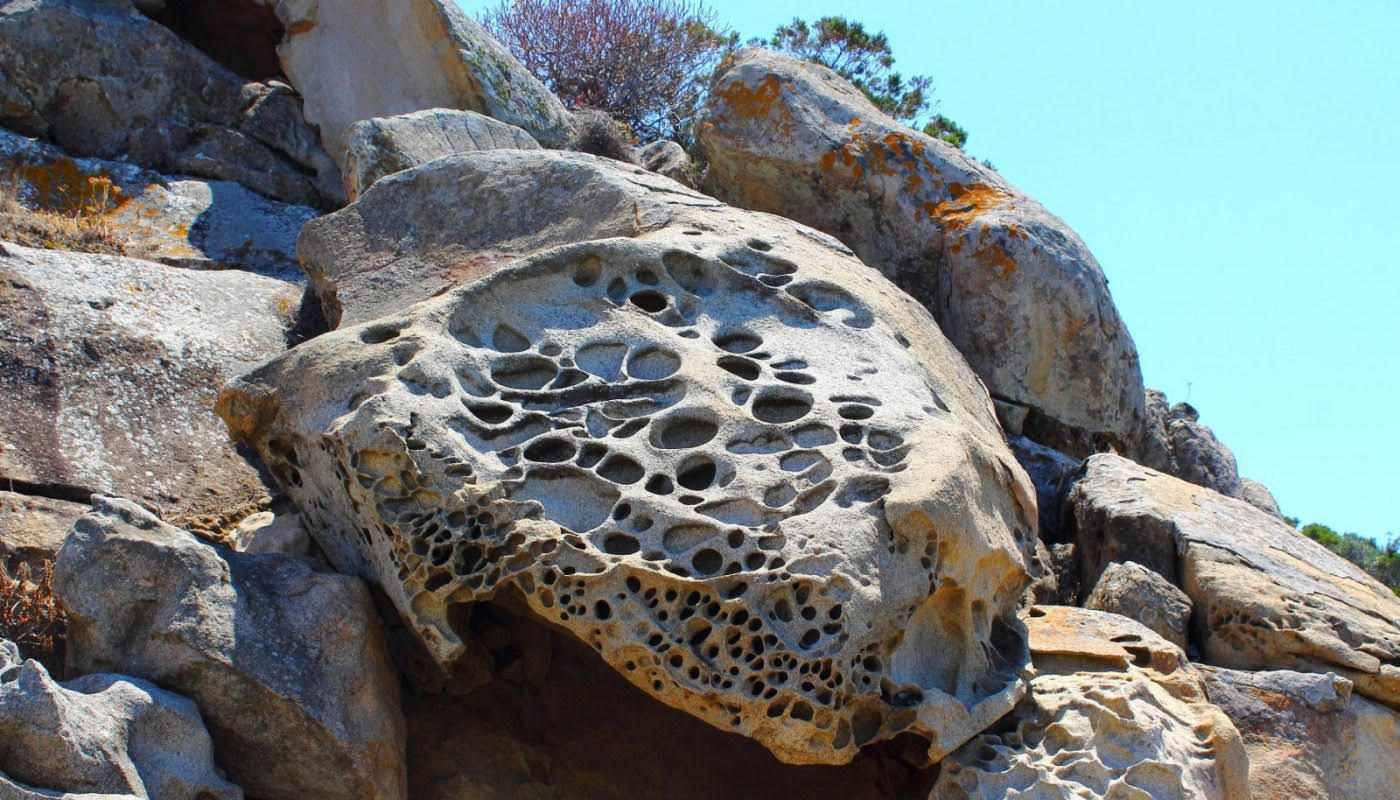
The second picture is a hole where one of these larger cobbles broke out of the sandstone. As rocks are exposed to the surface they undergo "weathering", where water, wind, and air cause the rock to break down into smaller pieces (again) before they are transported in rivers to lower elevations and eventually back to the coast. One last interesting bit of information is that these holes typically get larger and larger over time because wind can blow sand into them and swirl it around, which breaks down the rock more. You can think of the small grains swirling around in there as if you were rubbing sandpaper against it. This process is called "abrasion". So, if you're out hiking again and you see some sandstone that looks like a "honeycomb", you will know that some of those holes are formed from wind carrying small pieces of sand and it is wearing the rock down by abrasion (like sandpaper), and some of the holes were initially started where larger rock pieces broke out of the surrounding rock, as you noticed :)
Here is a cool picture of these wind formed features called "honeycomb weathering" in a sandstone boulder. |
Answer 2:
The rocks look like sedimentary rocks - sandstone
The dark circular region in P1 looks like it was a rounded sandstone of a somewhat different composition from the rock around it. I imagine that the rounded sandstone might be from a glacial moraine that later got covered with more sandstone. Here's a picture of a glacial moraine, in the 'moraine morphology..' section of this article.
And the hole would be where a little boulder came out - I'm surprised the hole is so deep. Here's a link to
boulders.
The rocks get rounded when they get pushed down hill by melting glaciers and such - sort of like a rock tumbler. Here's a link that looks interesting.
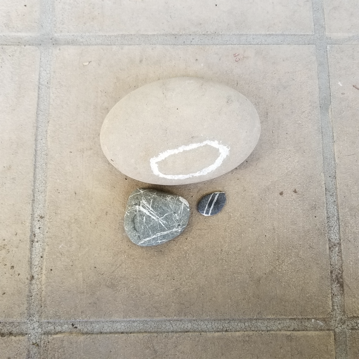
Here's my favorite rock
- the big one. My granddaughters think it's boring and just looks like bird poop fell on it. The white lines are dikes. The gray rocks get cracks that are filled with fluid rock.
Click Here to return to the search form.
|


